


- There were two plotted waterways through the isthmus.
 You may know that the isthmus is entirely fill. Meaning, the original shoreline of Olympia was somewhere along Water Street and didn’t extend any further west. Our early city planners began the process of filling and bulkheading early on. One reason was to create an easier way to get to Marshtown, or West Olympia. But, all that fill also provided more space for the town to extend, especially along the waterfront, where our early commercial success thrived.
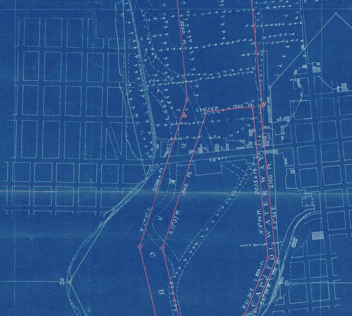
But, at one point, there were two paths for ships and other watercraft to ply southern Budd Inlet – Capitol Waterway and Deschutes Waterway.
The Capitol Waterway was to the east and served mostly Olympia. The Deschutes Waterway was to the west and overlaps was is left of the flow of the Deschutes River through Capitol Lake. The Deschutes Waterway passed by Olympia and served what had been Tumwater’s water based industries until the damming of the river to create the lake.
But, the Capitol Waterway was doomed by the western creep of the fill of the isthmus. Eventually, land cut off the path of the waterway and the Capitol Waterway was closed in the late 1890s.
- The first plan for development on the isthmus included tall governmental buildings.
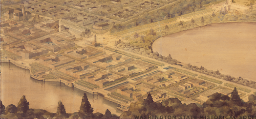
In 1911, plans for what the the Capitol Campus would look lie began being put down on paper. Among the concerns of the folks that were paying the bill for the plans and construction at the state was how Olympia itself would develop.
So, the architects in charge of the campus group plan wrote out some ideas for Olympia city founders to consider. One of those had to do with how the growing isthmus would grow. In their graphic representation of those ideas, the entire isthmus is covered with multiple stories buildings. In their words, the isthmus would be “a fine setting for all city and other public buildings.”
- Maybe there never would have been any isthmus at all.
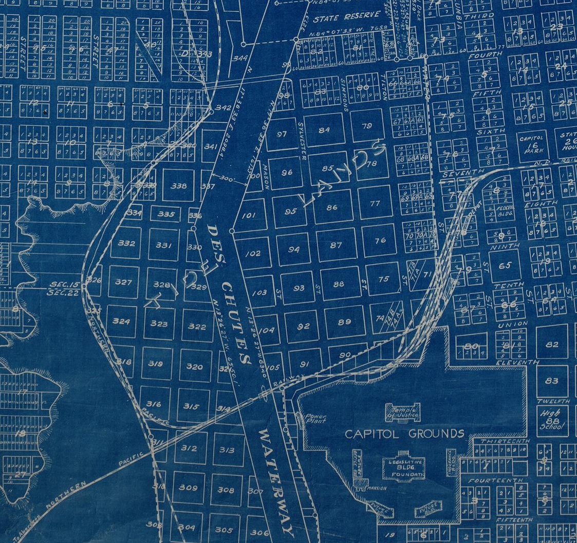
Some early city maps showed the natural filling progress of the isthmus not only pushing west, but also south, filling in most of what we think of today as Capitol Lake. For decades, the area covered by tidal water south of the isthmus was platted with city blocks. Between the 1890s and 1930s, the state sold the platted blocks to private landowners before needing to purchase them right back to construct Capitol Lake.
- The first park on the isthmus wasn’t built until the 1960s.
Now we think of the isthmus as a place of parks and recreation. Future parks will be built there, one of Olympia’s largest and most popular parks already exists there. But, even though it was situated near the water, it took decades until water recreation was possible.
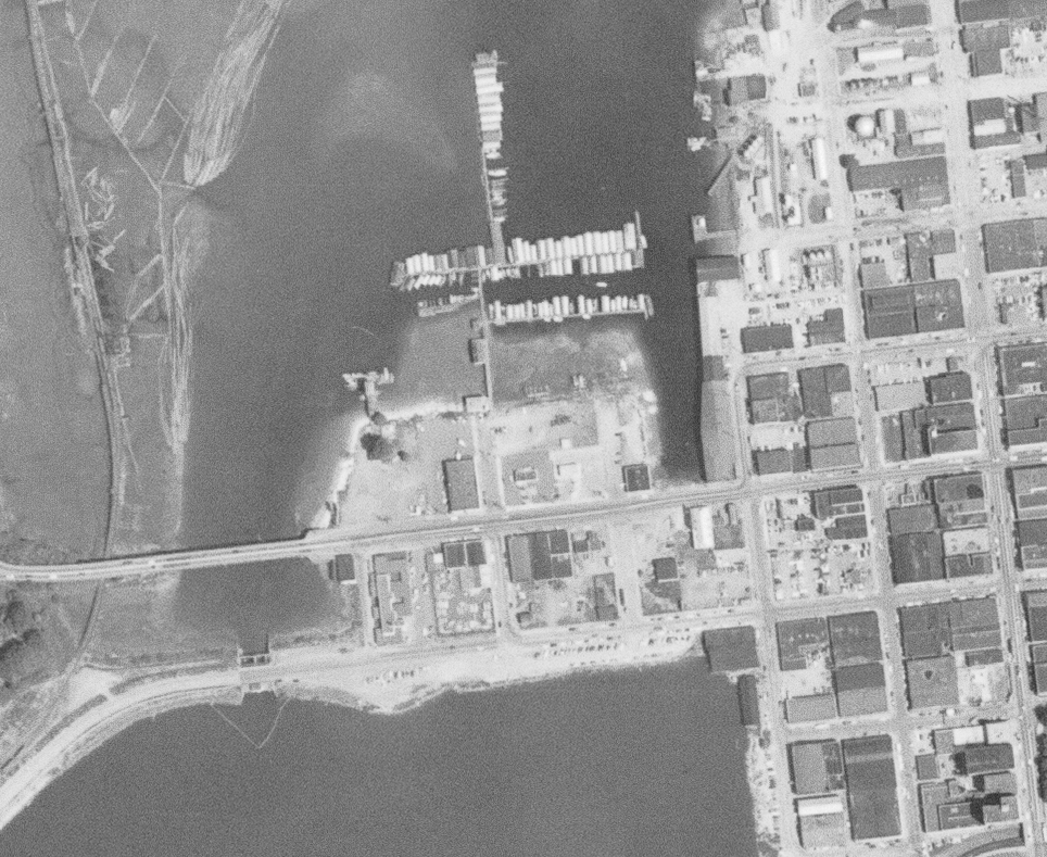
Actually, it was probably because of the water that the isthmus remained industrial and commercial for so long. The entire reason for the isthmus to be built (in addition to making it to West Olympia) was to facilitate water dependent industry and business. Even through the 1950s, aerial photos of the neighborhood show more businesses and no open fields.
- The Capitol Center building was heralded when it opened.
No single building has focussed the ire of locals as what we now call the “mistake by the lake,” but what is more formally known as the Capital Center Building. Finished in 1966, the building was the largest private construction project to date in the city, taking two years of planning and over $2 million to construct.
Contemporary news coverage of the building including gushing observations about the views:
If you look out of the windows of Olympia’s newest structure, facing north, you survey Puget Sound, the Olympic Mountain (when it’s clear) and the Budd Inlet shoreline. Do an about face, march through a couple of doors, and you’ve got about the best view possible of the Capitol group (unless you’re the governor).
And, the brand new building was also something to be proud of. “From the looks of it, a lot of local workmen and designers can stand proud of their new building,” said the news report.


